On the Megalithic Portal, you can view a map showing the position of excavations in Orkney – click here. Each site on our list includes links to Canmore, the Open Street Map, and the Megalithic Portal.
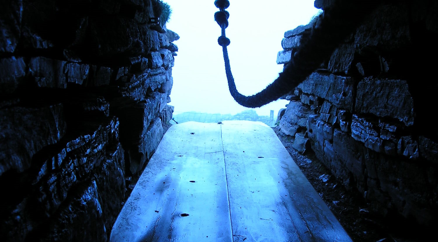
The opening image is of the Tomb of the Eagles by dai. Sourced from flickr | ccby4 licence
Banks Chambered Tomb [aka Tomb of the Otters] Cleat, South Ronaldsay (KW17 2RW Click for map) – currently closed. This Tomb appears to date from around 3340 BCE and was in use for several centuries. It is unique in Orkney as it was quarried out of solid bedrock. Only one of what looks like six chambers has been excavated (in 2010). Its second name arises from the discovery of otter bones not far from the Tomb of the Eagles. The land east of Banks (and south of the visitor centre for the Tomb of the Eagles) was explored in 2011. This revealed that there were ‘a significant number of prehistoric houses, dykes, fields, terraces etc, and some of these are elements of coherent settlements’ (Canmore). See, also The Megalithic Portal.
The Cairns, Windwick Bay, South Ronaldsay (KW17 2RN click for map). A fascinating site that has been featured on Digging for Britain [series 12, programme 3]. The current work at The Cairns began in 2006. It is exploring a large area, with the investigation now focusing on excavating a substantial broch or Atlantic Roundhouse (over 21m in diameter with five different internal areas). See Cairns for more details. There are also other Iron Age and Norse period structures. See Canmore and The Megalithic Portal. We also feature it in Places to Visit 5. 2025 Dig: This year’s season will start on Monday, June 9, 2025, and run until Friday, July 18. There will be at least one open day. It is currently scheduled for Friday, July 4.
Harra Brough, Broch or Nuraghe – Herston, South Ronaldsay (KW17 2RH click for map. There is some doubt about whether this is a Broch – the site is inaccessible and the approach is difficult and dangerous. However, viewed from the clifftop, the site is fascinating. The Megalithic Portal describes it as follows: ‘A rather mysterious site… located on an extraordinary coastal outcrop named The Altar on the OS map’ The Portal also has an excellent picture of The Altar [see, also, Canmore]. Accessibility: none.

Howe of Hoxa, Howe, South Ronaldsay (KW17 2TW – click for map). Situated on a hill that looks out across Scapa Flow to the Orkney mainland, and to Flotta and beyond, this Iron Age circular broch also affords views across fields to the nearby Sands of Wright and Widewall Bay. It can be accessed from the track to Howe. A path to the left of the house takes you to the site. Unfortunately, the broch looks to have been altered soon after it was first ‘dug’ in 1848. It has an internal measurement of just over 9m and there appears to have been a stairway to the upper floors. As we note elsewhere in these pages, Thorfinn Torf-Einarsson, aka Thorfinn Skull-splitter (who appears in the Orkneyinga saga), is said to have been buried here in around 963. [See The Megalithic Portal and Canmore]. Note: There is no official parking for this site, but it is possible to leave cars and bikes by the side of the main track (just past the secondary track to Little Hoxa and close to a farm building – click for map). From here, you walk a short distance down the main track to the coast. Here, you turn left to Howe and left again and then take the short – but fairly steep – climb across the grass. It is not recommended for people experiencing mobility difficulties.
Isbister Chambered Tomb aka Tomb of the Eagles. This is one of Orkney’s top archaeological sites and is over 5000 years old. When open, entry is via the Tomb of the Eagles Visitor’s Centre, Cleat, South Ronaldsay, KW17 2RW. Click for map. From there, you walk about a mile or 1.6km to the Tomb. Liddle Burnt Mound (see below) is on the path to the tomb (around 5 minutes from the visitor’s centre). The Tomb is located on cliffs not far from Isbister Farm (see Canmore and The Megalithic Portal for more details). Ronnie Simison, a local farmer, discovered the tomb by chance in 1958. The South Ronaldsay and Burray Development Trust is currently raising funds to take on the running of the tomb (see Crowdfunder).
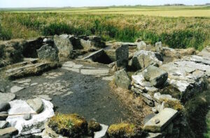
Liddle Burnt Mound, Isbister, South Ronaldsay (KW17 2RW, click for map). Liddle is said to be the best example of a burnt mound in Orkney, and given that there are around 200 of them, it is significant. From material gathered from the site, it looks like the building was in use from around 1200 to 500 BCE. Given the design of the building, the artefacts and burnt bones, and the prominent tank and hearth, it seems to indicate that it was used for cooking. The building was oval and measured around 6.5m x 4m. [See Canmore, The Megalithic Portal and Wikipedia].
Little Howe of Hoxa, Howe, South Ronaldsay (KW17 2TW – click for map). The Little Howe of Hoxa can be accessed by track/path from the track to Howe (described in Five Places to Visit – visit 4). It was a settlement – the ruins of which are now largely covered by grass. Some structures remain but are said to be prone to collapse. [See The Megalithic Portal and Canmore]. Accessibility: The site is accessed by a track and is not recommended for wheelchair users or people experiencing significant mobility difficulties.
The Wart, Hoxa Hill, South Ronaldsay (KW17 2TL, click for map). Close to the summit of Hoxa Hill and south east of an observatory, we find The Wart – a chambered cairn. Canmore describe it as a ’round cairn of Orkney-Cromarty type, probably with a tripartite chamber’. You can reach the cairn by walking up the track to the right of Roeberry House on the B9043 (click for map). Great views from the top. [See The Megalithic Portal]. Accessibility: The site is accessed by a track that appears OK for car drivers, and is not recommended for wheelchair users or people experiencing significant mobility difficulties..
See, also, the section on standing stones.
If you find any mistakes in this piece or think something needs adding, please let us know.
All photographs without acknowledgement: mks | CC BY-NC-SA licence.
Referencing this page: Smith, Mark K. (2025). Archaeological sites in South Ronaldsay, Exploring South Ronaldsay. St Margaret’s Hope. [https://exploringsouthronaldsay.net/archaeological-sites-in-south-ronaldsay/. Accessed: ]
updated: March 11, 2026