Go to: a quick history of schooling on the islands | Tomison’s Academy | Widewall School | Herston School | Hope Schools | Grimness School | Burray Schools
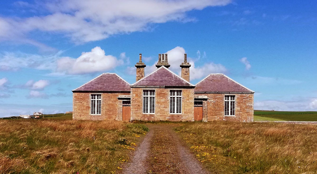
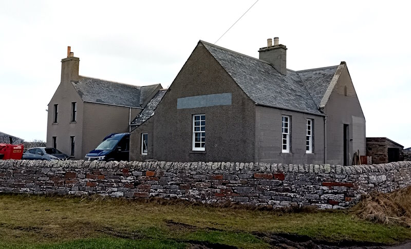
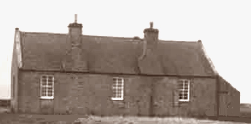
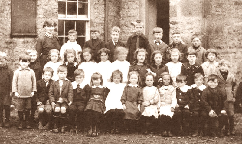
The opening image is of Tomison’s Academy in South Ronaldsay’s South Parish
We are going to take you through a quick history of schooling in South Ronaldsay and Burray, then go on a tour. Our starting point is Tomison’s Academy in the South Parish. It provides both an interesting story and an excellent opportunity to see the building, which is Category B Listed. From there, we head north and take in some key former and current schools. The route takes you to Burray.
Parish and other schools for children
By the late seventeenth century, the lowlands of Scotland were able to boast a near-complete network of parish schools. The Highlands and Islands could not (Anderson 2003). They were plagued by problems of distance and isolation, and by the lack of familiarity of teachers and ministers with Scottish Gaelic and local dialects. This meant illiteracy was common in more remote areas until well into the nineteenth century.
Most schooling was associated with churches and religious groups. There were some early examples in South Ronaldsay. For example, on March 18, 1666, the local Kirk Session agreed that a school should be established in St. Margaret’s Hope for the north district. The south district had one already (the forerunner of Tomison’s Academy). A Mr Walter Kynnaird, the first schoolmaster of the Hope School, was quickly appointed (Picken 1972: 37), but where any other schooling took place is difficult to identify.
Another initiative was linked to the Society in Scotland for Propagating Christian Knowledge (SSPCK – founded in 1709). They recorded, for example, the appointment of a schoolmaster based at ‘Brandequoy’, South Ronaldsay, from 1716-18. SSPCK in its early days focused on evangelising what were seen as Catholic areas, particularly in the Highlands. By the last decade of the century, Brandyquoy still appeared to be the base for a schoolmaster, but a local minister was still trying to persuade the SSPCK to establish a Society school in the parish (Picken 1972: 45). It eventually arrived in 1815.
The growth of Catholicism across Scotland (particularly with the large numbers of Irish immigrants following the Great Famine,1845 -1852) remained an issue for Protestant churches, but a further, major shift occurred. The so-called Disruption of 1843 created the breakaway Free Church of Scotland and fragmented local churches and schools. We see this in South Ronaldsay with the establishment of St Mary’s, St Margaret’s Hope around 1854 as a United Presbyterian Church, and the appearance of the South Ronaldshay South Free Church (around 1870). In Burray, the United Presbyterian Church appeared in 1847. [See Churches and chapels in South Ronaldsay and Burray].
Before the Education (Scotland) Act 1872, most schools were subscription-based. As we will see, we have one example of a free school – Tomison’s (see below) and one of a Parochial School (based at Brandyquoy from 1815). In 1842, there appeared to have been eight subscription schools in South Ronaldsay. These could be quite small and operated from the teacher’s home, or larger units linked, for example, to a chapel or church.
Free schooling for children
The 1872 Education (Scotland) Act profoundly changed the nature and direction of schooling. It required the establishment of around 1000 parish school boards that controlled the curriculum, finances and timetables. Generally, these boards took over control of most of the old and new Kirk schools and were able to start enforcing attendance. The Church of Scotland, for example, handed all its parish schools to the state following the Act. Many Free Church and Presbyterian schools were also assigned to the state. Rather than being called Parish or Parochial Schools, they were now described as Public Schools (but not in the fee-paying sense).
South Ronaldsay and Burray had their school board as a result of the Act. It was chaired by John Gray of Roeberry (close to the Sands of Wright) and included the Rev. A. B, Rogerson from the Burray United Presbyterian Church (who was also President of the island’s Temperance Society).
Parish school boards offered free education. Children aged 5 to 13 years were required to attend (although in rural areas such as Burray and South Ronaldsay, attendance continued to drop during harvesting, etc). All across Scotland, there were major school-building programmes. Classrooms were often overcrowded (70 students being common). One further key feature was the repression of Scottish Gaelic. Students were to be taught in English and punished if they spoke in Scottish Gaelic.
By 1884, there were five public schools in the Parish (Burray and South Ronaldsay had become a single parish): Burray, Grimness, Hope, Widewall, and Tomison’s Academy. A sixth school in Herston joined them in 1888. Now, there are two schools, both primary. Secondary school education takes place in Kirkwall.
The school leaving age was raised to 14 years in 1901. The 1947 Act defined the compulsory school age as five to fifteen years. In 1972, it was raised to 16 years [see The Educational Institute of Scotland Education Timeline]. Over this period, there was a significant decrease in the population of South Ronaldsay and Burray. In 1881, for example, there was a population of 3305 on the two islands. In 2022, they had a population of 1440. While this reflects significant growth in recent years, with an ageing population, the percentage of young people and the actual number of school students have dropped.
For readers unfamiliar with the current Scottish system, primary education (P1-P7) is for 5-12-year-olds, and secondary education (S1-S6) is for 12-18-year-olds. The latter looks to provide a broad general education until S3 and then encourages specialisation. Another distinctive feature of schooling in Scotland is that wearing a school uniform is not compulsory (although quite a few schools encourage wearing a school jumper or hoodie when going on trips, etc.).
We now turn to the schools themselves.
Tomison’s Academy
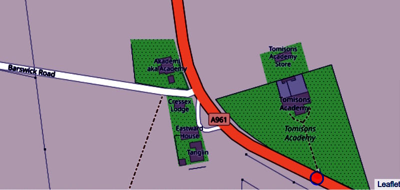
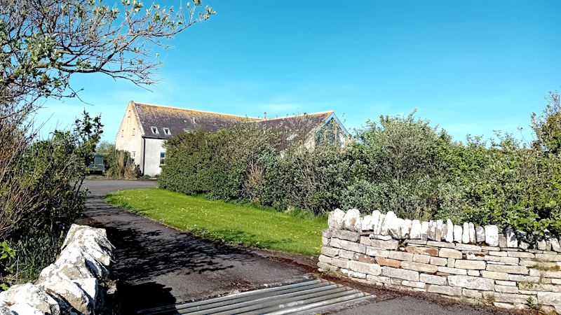
Getting there: Tomison’s Academy is on the A961 about 9km (or 5.9 miles) south of St Margaret’s Hope, and it is easy to identify. To the west, you will see an old church and to the east, the old school building in the middle of a field. Park by the entrance to the school, not by the old church. [Click for map]. Access is via a track across a field.
Tomison’s Academy was created by a legacy by William Tomison (1739-1829). It was to provide free education to children of the Island of South Ronaldsay, which it did until its closure in 1968. Tomison is believed to have been born in South Ronaldsay. We know little about his early years other than ‘his origins were humble and that he received no formal education’ (John Nicks 1987). At the age of 20 (in 1760), he signed on with the Hudson’s Bay Company as a labourer based in Canada. Over the years, he worked his way up the Company, and many of the people he came to manage were from Orkney [a large number of Orcadians worked for the Company at this time]. He lived in Canada (much of the time inland) and only very occasionally returned to London and Orkney. He became the inland chief. As John Nicks put it:
The comparative isolation of the inland posts had tended to solidify his natural preference for a solitary and Spartan existence. He showed little interest in social intercourse with his fellow officers and they in turn grew to dislike and then to resent deeply his parsimonious ways and his growing rigidity.
He retired in 1803 but soon wearied of the experience, returning in 1806 to take up junior roles. In 1810, he finally returned to South Ronaldsay and Dundas House. His temperament was not, apparently, well suited to being neighbourly. He also had no direct heir. As a result, he bequeathed a large part of his accumulated wealth to establish a free school for local children.
Tomison’s Academy appears to have become a Public School under the management of the South Ronaldsay and Burray School Board in 1902. It closed in 1968. From this point, all state primary schooling in South Ronaldsay was based in St Margaret’s Hope.
There are three places to visit here: the school, Tomison’s home, and the old schoolhouse close by his home.
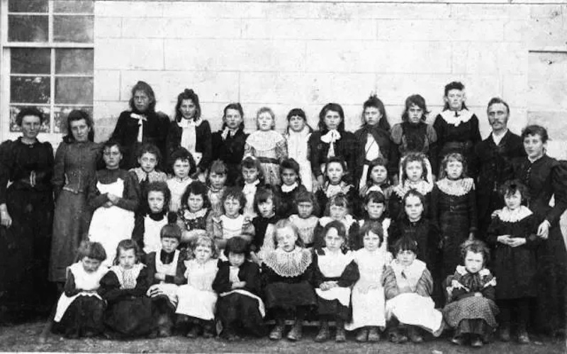
 The school: Enter by the gate and walk up to the school. The building is unused and deemed ‘moderately at risk’ (by the Buildings of Scotland Register of Scotland). It is listed as having been built in 1851. Tomison’s Academy is a Category B Listed Building, and it is easy to see why in its design, heating arrangements and execution. When it opened, it had 170 pupils (or 57 pupils per classroom – a not uncommon size at the time. The playground was at the back of the building, along with toilets, etc.
The school has been closed for nearly 60 years, but luckily, it has not been converted. This means you can walk around the building and peer through the windows. Looking in, it is easy to imagine what it looked like 150 years ago.
Dundas House: From the school’s front gate, you only need to walk a few metres south, and on your right is the track to Dundas House. Walk along the track, and as you get closer to the house, you will see Dundas Cottage. Next to it is a Corn-drying Kiln. Kilns like this could often be found in Orkney and were a necessary part of life on steadings like this. The reason for a kiln was that it was often not possible to harvest grain in dry conditions. The two main grain crops here were oats and bere (a form of barley) (click to see Professor John Hume’s notes on Canmore). Access via a track.
Dundas House was commissioned by, and built for, William Tomison. He lived in it from 1810 to his death in 1829. Even after death, he didn’t leave. He was laid to rest in the front garden [Click for map]. He is said not to be keen on burial in the churchyard as it had too many rats. Sixty years later, the Ordnance Survey Name book (1889-90) recorded that Dundas House was in the ‘occupation of Thomas M. Cruickshank, Head Teacher of Tomison’s Charity School’. Interestingly, it is reported as the property of the Trustees of that institution.
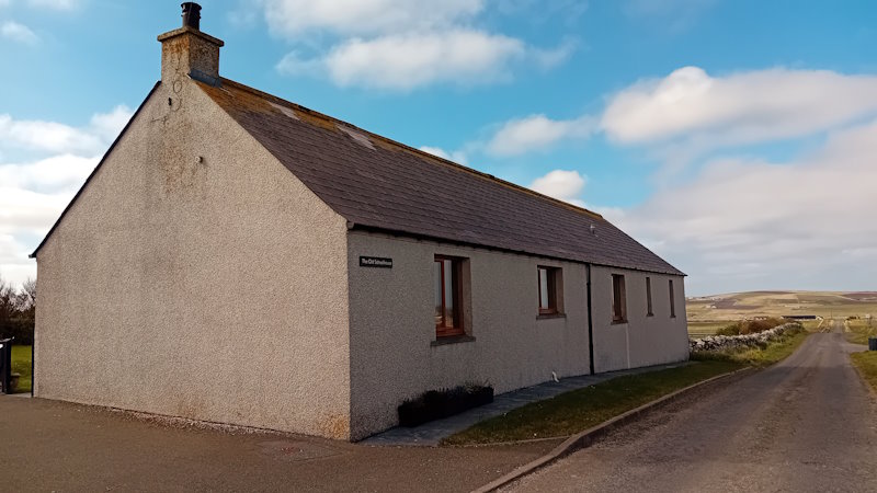
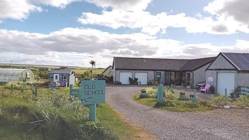
The Old School House: We find the Old School House – the forerunner of Tomison’s Academy – just a little further up the track to the west. There appears to have been a church school in the south of the island since at least the mid-1600s. There was certainly a South Parish School at the time of the 1821 Census with Theodore Rainy listed as the teacher (and the next Census listing is William Tomison, Dundas House) (click for the transcription). Access via a track.
On the right of the entrance to the house is a Threshing Barn. British Listed Buildings describes it as a ’19th century, central single-storey threshing barn flanked by a rectangular kiln and byre. Coursed rubble flagstone’. It is listed as a Category C Listed Building.
Widewall Public School
Getting there: Widewall School is on the main road [A961] that starts in Burwick (and then passes Tomison’s) in the south. Widewall is close to 6km or 3.7 miles north (click for map).
Inspection reports indicate that the school provided education that, in the words of one, was ‘on the whole good’ and in senior years ‘written composition was fluent, but there was a proneness to careless sentence-formation and clause-connection’ (1931 – taken from the Widewall School Log Book 1919-1967). Twenty or so years later, things appeared more variable and the building was showing its age (1953 op. cit.).
In the mid-1960s, the Education Committee of Orkney Islands Council decided to close Widewall School and transfer the students to Hope Primary and Junior Secondary School. Additional accommodation was required there, and the move was delayed to the summer of 1967.
The last entry in the school logbook was from 26th June 1967. It reads:
Last day of school
Weekly attendance 100%
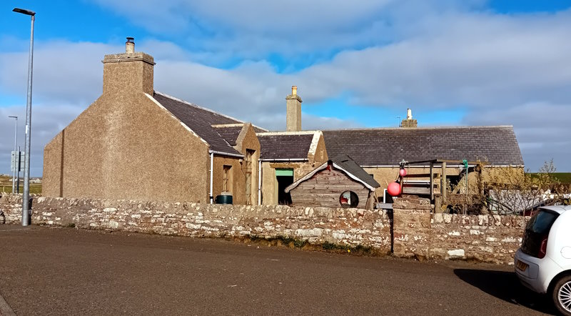
The School is now known as Widewall View.
Herston Side School
Getting there: To get to the site of Herston Side School from the old Widewall School, you take the road just past the tyre shop, but on the opposite side (Oback Road). This will bring you to the B9042 and Widewall Bay. Here you turn left towards Herston. As you drive by the side of the bay, you will pass by the old Herston Mission Hall (see the next paragraph). The school site is by a sharp corner on the outskirts of Herston – click for map. It is just over 4 km from Widewall (or 2.5 miles).

The remoteness from the Parish Church of Herston, Widewall and Sandwick necessitated the observance of public worship in the Herston School. This building was so uncomfortable and inconvenient that the people could not give regular attendance. (Picken 1972: 74)
Herston Side School opened in 1888, bringing the total number of publicly provided schools in Burray and South Ronaldsay to six. It began with seven students, and the school day was initially from 10 am to 4 pm. Mary Norquoy was the teacher. By the third week, attendance had risen to 17.

With a limited catchment area, the number of children attending the school was always relatively low. For example, in 1920/1 there were just eight on the roll. In a 1921 report by the School Medical Officer, it was described as ‘an old one single storey building forming one room measuring roughly 28ft by 14ft. Three feet of this is divided by a 7ft partition into a space for coals etc., and a coal store’. [Herston Side School Log 1921-1939]. It went on to report that the windows were badly in need of repair, the plaster on the walls was broken in many places, and that ‘dampness was evident throughout the whole building’.
There was just one teacher, so much fell on their shoulders. In August 1934, Eliz. L. Ritchie, a new teacher, reports:
This school was reopened on Tuesday 28th August, As will be seen from the last entry, it has been closed for two years. During that period, the Herston children attended the Widewall Public School. Now this school has been reopened and I have been appointed teacher here and have started with a roll of 6. The school has been redecorated during the holidays and dual desks put in. The percentage of attendance for the week is 95.24.
The last entry in the school log is dated 29.6.39. It reports:
Six openings. One day (Tuesday) closed for the Parish Picnic. Today we close for the session.
Hertson Side School never reopened. Books (and possibly other resources) were transferred to the Widewall School. The building was demolished in the 1960s.
Hope Schools
Getting there: Hope Community School is on the edge of St Margaret’s Hope on the aptly named School Road. It runs from Cromarty Square and the Smithy Museum, and continues to the Sands of Wright and Hoxa Head. However, before you head there, we suggest you visit the Old Schoolhouse.
If you are coming from Herston, it is a 7km (or 4.25-mile trip. You go back along the B9042 (but do not turn up the road to Widewall). This will take you past Kirkhouse Water Mill – and it is worth a stop (go to the section on mills).
On reaching the A961, turn left and watch out for the St Margaret’s Hope sign and 40mph speed limit. Look out for a turning on your right that is signposted to the Cemetery and St Peter’s Kirk. The war memorial is on the corner. Take that turning onto Haybrake Road, and just after 0.6 km or 0.4 m you will see a road to your left (Claybraes Road). You have arrived at your destination – The Old Schoolhouse. [Click for a map]
When you have finished here, turn around and return to A961. Turn right and take the next left turning (St Margaret’s Road). At the bottom of the hill, the road turns fairly sharply to your right. Slow right down as School Road is a sharp left as you enter the Square and is obscured by the public toilets. The school is close to the top of the hill. Click for a map. Coming from Widewall, head north on the A961 and look for the signs as you get close to the village.
The North (Parochial) School / Brandiquoy (now known as the Old Schoolhouse)

Parochial schools were generally linked to a local church and tended to emphasise religious education. This school was attached to St Peter’s Church, Kirkhouse, and this is where Haybrake Road leads. About 800 metres further along the road is the former church hall (Hill Hall), and the Kirk is another 1700 metres, or just over a mile.
One of the most interesting Parochial School Masters was James Forbes. He had previously taught in Caithness, Hoy, and Stromness. His obituary (Orkney Herald, May 28, 1890) described him as ‘an antiquarian of considerable research’ and having extensive ornithological knowledge of Orkney. He was in his 94th year. It is said that around 1840, he had ‘about a score of eagles’. Apparently, the ‘boys ‘made it their business to hunt up all manner of carrion and bring it to school with them to supply this carnivorous lot’ (op. cit.).
The Parochial school had a significant catchment area. The village was 10-15 minutes walk away, and the surrounding area took in quite a few crofts and farms. Church of Scotland Parochial schools were handed over to the Scottish Government following the 1872 Education Act, so quite a few children attending this Schoolhouse will have transferred in 1875 to the new public school in the Hope.
St Margaret’s Hope Public School


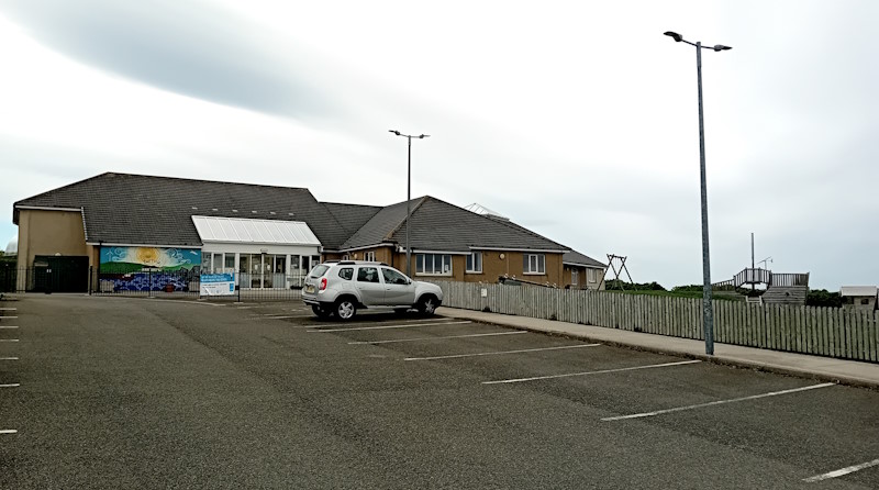
Hope Community School
The new school building was officially opened in 1990 and is currently described as including the Hope Community Centre and a Healthy Living Centre. The latter is housed in the old school building. The former relates to providing community rooms and the activities of the South Ronaldsay Community Association, which is based there. According to the Orkney Islands Council website and government statistics, the school is named ‘Hope Primary School’.
Alongside provision for years 1 to 6, the school provides nursery facilities. Recent Scottish School Roll and Locations data categorise the school as situated in ‘a very remote rural area’ and list it as having 54 pupils on the school roll (data.gov.uk, 2025, click for details). The school also has a large playing field, good parking, and is accessible.
The headteacher for this school also manages Burray Primary School. The associated secondary school is Kirkwall Grammar School.
Grimness Public School
Getting there: Another case of returning to the A961 and then travelling northwards. This time, you are looking east (right) for Grimness Road. It is 2.9 km (or 1.8 miles) from the turning to St Margaret’s Hope. What was Grimness School is about 1 km or 0.6 miles from where you leave the A961 [click for map].

In 1964, the South Ronaldsay and Burray School Board/Management Committee recorded that it was desirable to close the school as ‘the number of children involved is very small and also in view of the rather lower numbers at Hope J S School’. The school closed in the summer of 1964.
Burray Schools
Getting there: The old and the new Burray Schools are easy to find. If you are coming from Grimness, you return to the main road, turn right, and head for the fourth barrier. Follow the A961 until you see the bus shelter at the top of Burray village (it will stand out as Orkney is known for its lack of bus shelters). It is just a case of turning left and parking in the car park opposite the community centre. The previous village school is by the car park and close to the bus shelter. The new school is a few steps along Westshore Road from the community centre (not down the hill to the pier!).
Burray School has had several different homes. The first record of a school dates back to 1627, but we know little about it. Similarly, we know from the 1821 Census that there was a school, but again, nothing major about it. However, in 1840, a new school was built by local people. It was located on the corner of what is now known as Viewforth Road and Bu Road, opposite the Baptist Chapel [click for map]. A year later, this subscription school had 109 children (aged 4-11 years) (see the chapter on education in J. M. Struthers’ 2013 book).
The headteacher for this school also manages Hope Primary School. The associated secondary school is Kirkwall Grammar School.
References
updated: November 23, 2025