Image: A Hope Full Of Sound – Sheena Graham-George
As I made my way back to Kirkwall, the late afternoon light danced on the surface of Scapa Flow, golden and still, belying the secrets lying beneath. My visit to The Hope was everything I had wished for: peaceful, scenic, steeped in history yet unspoiled by it. The quiet roads, the echoes of sunken warships, the welcoming pub staff, and the preserved stories inside the Smiddy all reminded me that even the most remote corners of the world have deep wells of memory, just waiting to be uncovered.
Merge and Al’s Visit to St. Margaret’s Hope
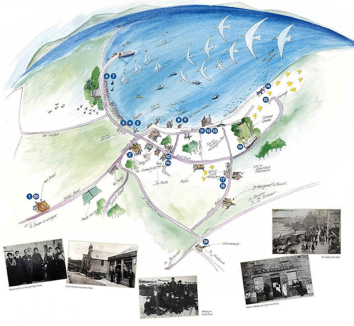
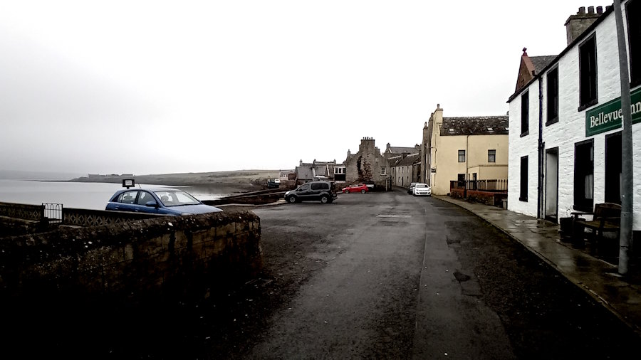
Many people, like Merge and Al, begin their visit to St Margaret’s Hope either in Cromarty Square or the harbour [click for the Pentland Ferries video – it has some great shots of the bay]. The Square is where the buses and coach tours stop, but it is also a great starting point. If you are in a car, with luck, there will be a free parking space; otherwise, it is a case of street parking or heading up to the Church Road car park via Back Road (click for a map).
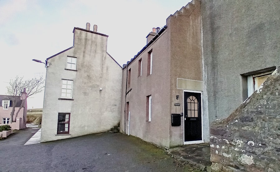
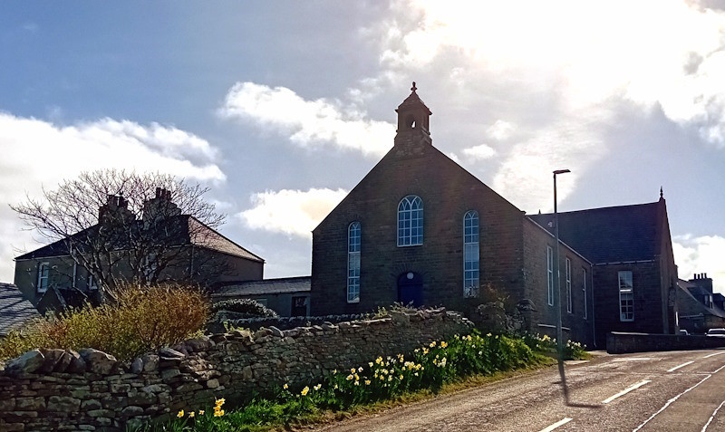
There are toilets at one end of the Square, next to the Smiddy Museum, which, as we can see above, is well worth a visit.
In the middle of the Square is the Cromarty Hall. It was donated to the people of South Ronaldsay in 1878 by William Cromarty and has served the community ever since. Over the years, it has hosted innumerable dances, concerts, weddings, parties and pantomimes, as well as countless fund-raising events and even military funerals. It also operates as a cinema, has a secondhand bookshop, and hosts The Repair Cafe and Bite and Blether.
At the other end of the Square (by the corner with the anchor), you can view the bay, harbour and surrounding countryside.
From here, it is easy to tour St Margaret’s Hope and return to your starting point. By clicking the play symbol (a white arrowhead on a black background that runs across the page), you can listen to local people talking about the village’s history as you move around. These pieces can be short—just over a minute—or longer, perhaps five minutes or more. If you miss something, you can always click on the blue line and pull it backwards.
There are also plaques with QR codes dotted around the village. You can scan these codes with your phone and listen.
Accessibility: The first part of the walk is flat, but involves crossing roads and walking along a street with limited traffic. It has eleven stops and some great views across the bay. All bar one stop (14) are reachable by car; however, four (6, 7, 14 and 19) lack suitable pathways to them for people with mobility difficulties.
Sheena Graham-George
The Burwick, Kirkhouse, and St Margaret’s Hope Listening Walks (and their associated maps) featured on these pages were developed from two grants awarded to local artist Sheena Graham-George by the Culture Collective Fund to bring communities together after Covid. She worked with different folks in the community. The result is a fascinating collage of local life. You can view other elements of Sheena’s work via her website: https://www.sheenagrahamgeorge.com/.
Special thanks are also due to Herbert and Ingrid Mackenzie. Their considerable knowledge of St Margaret’s Hope and collection of pictures and notes on the village have been a great help to what follows. The Smiddy Museum is also a great source of information and is well worth a visit.
Beginning the Listening Walk
Stop 2: Sledging
[Herbert Mackenzie and Janice Thomson]
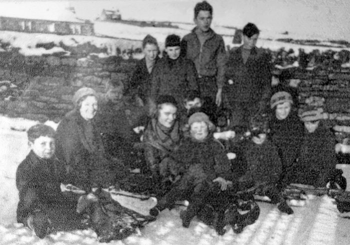
When it snowed, children used to sledge down School Road and into St Margaret’s Hope’s Cromarty Square. This was before the days of the road to the left of the Smiddy that leads to the main road.
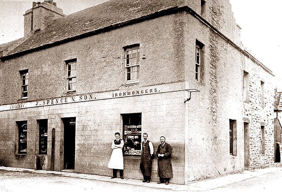
To the left of the anchor, you will find three white squares attached to the lamppost. These are Stops 3 – Spence’s Pier; 4 – Spence’s Stores; and 5 – Cafe. Alternatively, you can click the links below to listen.
Stop 3: Spence’s Pier
Herbert Mackenzie and Janice Thomson
This picture was probably taken in the 1890s or slightly later and is believed to be in the public domain. The area to the lower right looks rather different today. It now hosts the outlet for water draining from the hillside, which, in turn, has been capped by the propeller.
For many years, Spence’s pier was the main point for people to embark on and disembark from steamers and ferries. They were taken to and from St Margaret’s Hope on smaller boats. It was also the place where mail arrived (and much of it was taken from here to Kirkwall). Across the main road, you can see that what became the Legion Hall (and now a house) was then a shop (D. McBeath’s). Indeed, quite a few of the buildings on Front Road were shops and are now wholly residential.
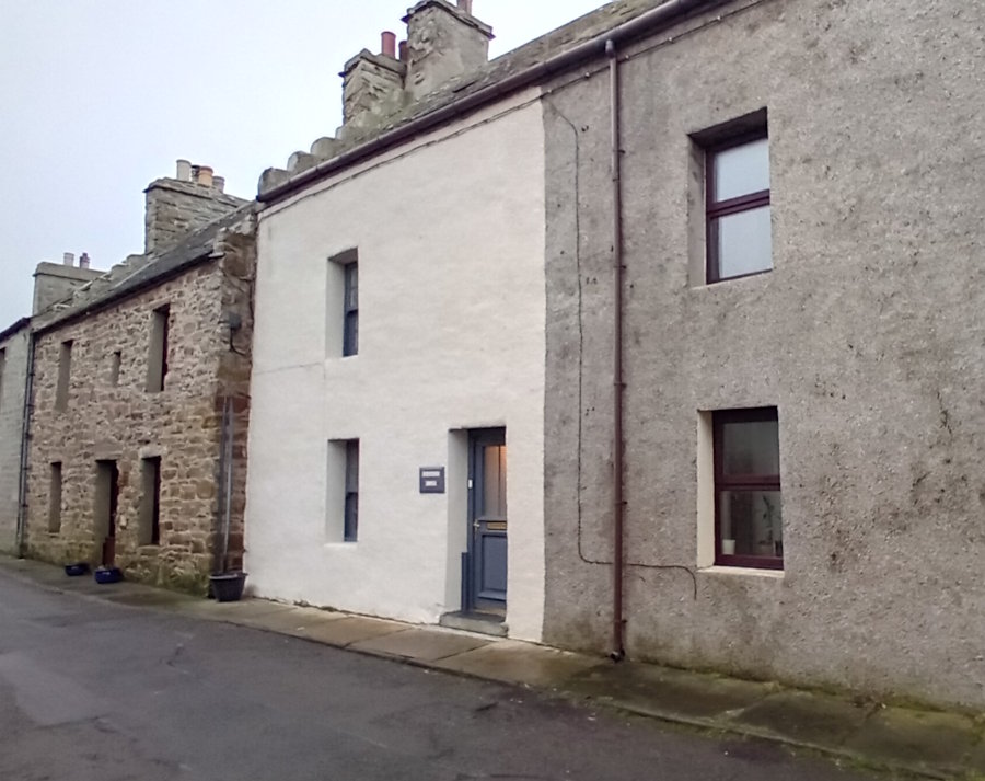
Stop 4: Spence’s Storehouses and Shop
Jane Phillips and Janice Thomson
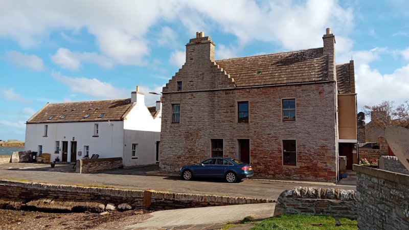
The front end of Spence’s Storehouses (by the side of the pier) has now been converted into two cottages. It was also the site of a petrol station with two pumps.
On the other side of the road (opposite the propeller), you can see what was the J. Spence and Sons shop. Now known as The Anchorage, this building is Grade C-listed and was previously called Corner House. The main entrance to the shop and the display windows were just around the corner on Front Road.
Jane Phillips and Janice Thomson reflect on their experience of the shop and the range of goods it sold. As Jane Phillips says at the start, it sold all sorts of things but mainly focused on hardware and ironmongery.
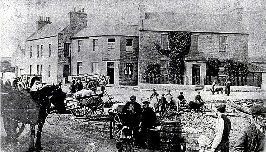
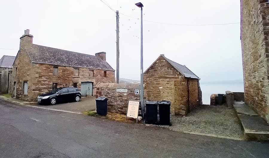
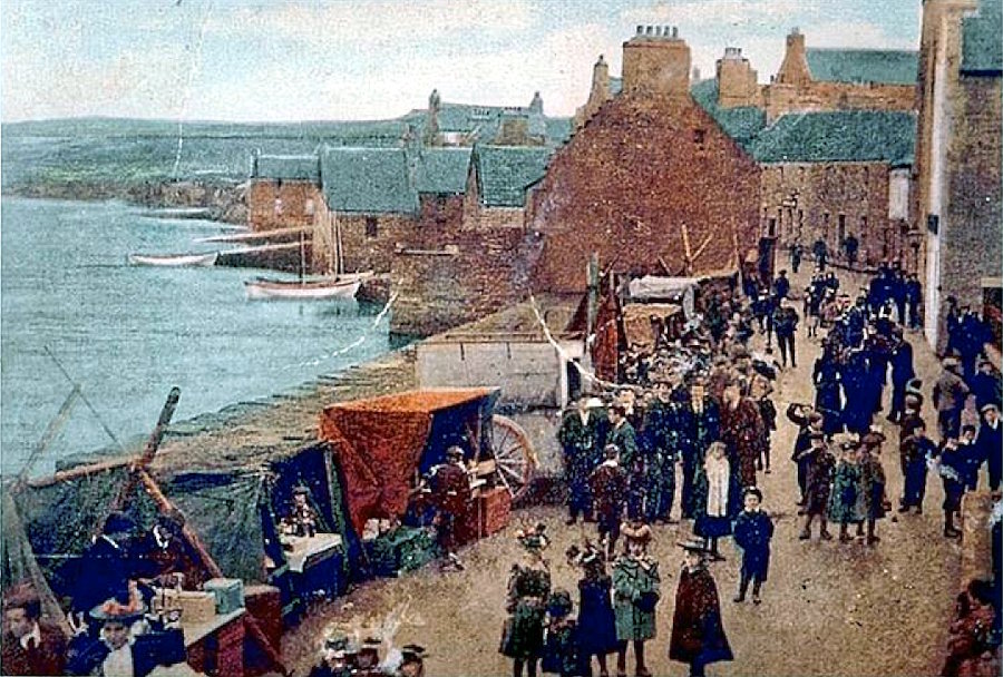
The shop was run by Janice Thomson’s parents. As she reports, Spence and Sons also stocked paint, paraffin, and fuel, as well as groceries and meat. For youngsters coming down the hill from the school, there were sweets to be chosen. Flooding at certain times is a problem for this part of St Margaret’s Hope. It affected the shop and store, but not the house. As shown by the following postcard from George Sinclair’s (a bookseller in the village) from around 1915, it did get fairly wet.

Today, council workers now erect protective barriers both between what was the shop and the stores, and from The Anchorage to the wall by the propeller.
Stop 5: Cafe
Yvonne Widdall and Jane Phillips
The Cafe was just along the road leading to Lowertown and the harbour, roughly on the site of Seaview today. It consisted of three buildings, the first of which was much closer to the road than the current building [click for mapview].
Front Road and Marengo
Front Road was the heart of St Margaret’s Hope in its heyday as a fishing port. The bank, post office and various shops were here, alongside slipways for boats, sheds and warehouses. As we have seen, the two cottages by the slipway were, in fact, originally Spence’s stores. Today, the first shop (and only shop on Front Road) is the Workshop and Gallery (a craft co-op). Previously, the shop had been Leith’s – the clothier and draper. Between Spence’s storehouses and Leith’s there was also Tom Hocker’s Shoe Shop. While many of the buildings we see today have been around for years, many looked rather different back then, with displays of goods in the windows and signs advertising their presence. The road could be busy, with an occasional market and fairground where the car park is now, and people out shopping.
After Spence’s Shop, you can see the Harbour Master’s House and Harbour View. Historic Environment Scotland describes the latter as ‘a fine, little altered, early example of the traditional style of building found in St Margaret’s Hope’. It is listed as a
Category B Listed Building, and is thought to have been built by the then harbour master. Harbour View has changed – it was actually double-fronted when it was built (i.e., a design similar to what is now called The Harbour Master’s House). The right-hand side of the building was later incorporated into Westend, aka West End.
Your next QR stop is next to the Front Road road sign. Under it are two QR codes – 8) which discusses Leith’s shop, and 9) about cows. However, before you get to it, you go past what was Leith’s shop and is now the home of the Workshop and Loft Gallery, so it is worth stopping here.
The Workshop was set up in 1978 as a craft producers’ co-operative by three craftspeople: Elli Pearson, a potter; Rosie Jarrett, a weaver; and Peter Leach, a woodcarver. Its first premises were in an old bakery just off Back Road in St Margaret’s Hope that needed extensive renovation to make them usable. It opened its doors in July 1978. Soon, local knitters became involved, and their knitwear became the core activity of the business. In 1982, the group registered as a Friendly Society with a membership of ten. By 1999, the business had expanded and needed to move to new premises. It relocated to what had been Leith’s shop.
Stop 8: Leith’s shop
Jane Phillips

Jane Phillips describes the shop as small, friendly and cosy. As we will see later, there were around 12 shops along Front Road, but, as she points out, many people also shopped where they lived. Grocery vans came to them. We can see from the picture above that Leith described itself as a clothier and draper, and, as Jane points out, it was not the only one. Another feature of Saturday visits to the shops for her was the purchase of comics, newspapers, and the People’s Friend for her mother.
Now walk along to the Front Road sign on your left (the QR codes are just beneath it). The building between you and the sea housed the old public toilets.
Stop 9: About cows
Herbert Mackenzie
Herbert Mackenzie describes how, as a youngster, he used to bring Jock Robinson’s cows down from the fields to the east of St Margaret’s Hope. They came through the village and along the road behind you to be milked in the yard to your left (where the car is parked). Some of the milk was used in breadmaking (there was a bakery opposite the yard). The milk was also, according to Herbert, mixed with feed in raising the calves. The building next to the yard housed Bob Watts, the butcher (see Stop 12 below).
The white building opposite the toilets (now part of the Bellevue Inn) was the local Co-op branch. In Scotland, the co-operative movement emerged in the second half of the 18th century, and by the early 1900s, there were hundreds of Co-operative shops. Today, two remain in Orkney (in Stromness and Kirkwall). However, as we have already seen, the tradition of co-operative shops continues in the form of the craft shop just down the road.
.
The area on the other side of the houses next to the toilets was the site of St Margaret’s Hope marketplace. It was also where, over the years, the fairground was set up. Today, it is a car park.
Fishing. If you look out into the bay, to your right, you will see some surviving slipways (there were more in the heyday of the fishing industry). In the early 1800s, a herring fishery was established here. This meant St. Margaret’s Hope expanded. Herring fishing was seasonal and generally lasted for around six to eight weeks before the boats and the women charged with cleaning and salting the fish moved on to the next fishing port (in our case, generally, Wick on the mainland). However, the village was also a base for deep-sea and salmon fishing. Scapa Flow was, in addition, an important source of lobsters. As we see elsewhere on Exploring South Ronaldsay, the fish industry is still flourishing here. It has been augmented by the growth of salmon farms, three of which are serviced from the village [click for more information].
Banks. Walk along the road to the far side of the car park. On the other side of the road, you will see a red-bricked building. It was a branch of the Royal Bank of Scotland. Back on the sea side of the road and next to the car park, you will find Old Bank House. It was home to another bank, the Union Bank of Scotland, which then became the Bank of Scotland in 1955. This branch closed in 1966.
![]() More listed buildings. Next to the red-bricked former bank are three listed buildings in a row, dating from the late Eighteenth Century. These are:
More listed buildings. Next to the red-bricked former bank are three listed buildings in a row, dating from the late Eighteenth Century. These are:
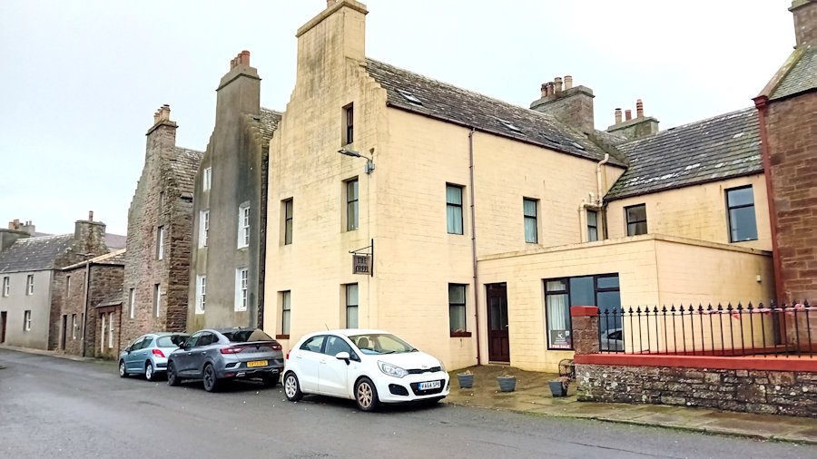
St Margaret’s House – which became the St Margaret’s Hotel and is now known as The Creel (Category C).
Lairdene – now known as Waterside (Category C) and described as having 2 1/2 storeys. It is similar to Swanson House (below), but harled, i.e., the stonework has been plastered with a slurry of small pebbles or fine chips of stone.
Swanson House (Category C), another later 18th-century house of 2 1/2 storeys. A path runs between Lairdene and Swanson House, leading to their entrances.
On the wall of Old Bank House (next to the car park), there are three more QR codes for the St Margaret’s Hope Listening Walk.
Stop 11: Herbert Mackenzie’s shop
Herbert Mackenzie
It was Herbert’s father who ran the shop, and before that, his grandfather Hugh Mackenzie]. The shop was converted and became part of the Bellevue Inn—the front door is now the central window under the Inn sign.
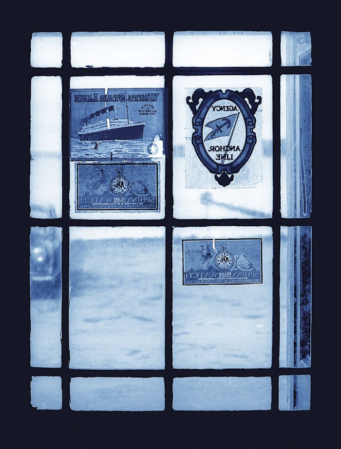
As can be seen from the signs in the door’s window, besides being a jeweller and watchmakers, Mackenzie’s was an agent for the White Star Line and Anchor Line. There was a demand for these services as a significant number of people from South Ronaldsay went to the United States and Canada to find work. One important example is William Tomison (1739-1829), who returned from Canada and went on to found Tomison’s Academy.
What Herbert has to say about his father is fascinating. As well as running the shop, he was clerk to the district council, the local registrar, and the person that many people would go to for money advice. The shop was also a place where older men would gather and talk. We hear how Herbert Senior got into building wireless sets, charging batteries, and conducting eye tests. Alongside this, he developed an interest in beekeeping and in the medical benefits of bees. He also dealt in sheep. In short, he was a local character. Click to listen to Herbert’s conversation with Sheena.
Stop 13: The Crafty
Bill Dass, Yvonne Widdall, Jimmy Wishart
The Crafty was the name for the fair that took place each year in the parking area opposite Mackenzie’s and the Bellevue Inn. The event took place following the Annual August County Show in Kirkwall. Most of the stands had been there and then transferred to St. Margaret’s Hope. The fair hosted bingo (housey house), coconut and three tins stands, a shooting range using air rifles, the chance to win goldfish and various other attractions.
Another annual attraction here in the early 1900s was a market. It took place on a particular Wednesday in November.
Stop 12: Front Road
Dick Brown
Dick Brown, to round off this section of the Listening Walk, lists the shops that were on Front Road. [We are just in the process of adding the shops to a 1903 Ordnance Survey Map, which will be inserted here. Today, there are three shops in the village. Eighty years ago, there were at least 26.
From this point on, the walk involves steps, uneven pathways, and fairly steep hills. If you have limited mobility or use a wheelchair, we advise you to turn around and then take the first street on your left (just past the Bellevue Inn). Ahead, where the road meets Back Road, you will see the Murray Arms. Then click to rejoin the walk at stops 10 and 10a.
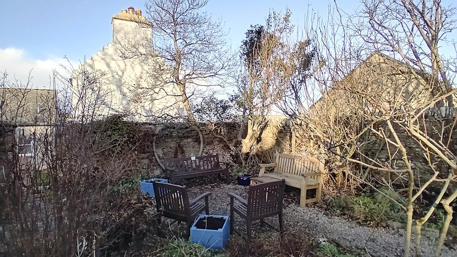
If you are continuing on this part of the walk, carry on along the street until you reach a second parking area. It is by what was George Sinclair’s shop, selling books (see below). Carry on to Garleton Cottage (the pink building just ahead of you). Turn right and walk up the steps. At the top, continue straight on to the wrought iron gateway depicting various garden tools. This is the Marengo Community Garden.
The Marengo Community Garden was established and is maintained by local people. It is well-used. You will find a large map of the St Margaret’s Hope ‘Listening Walk’ by the front entrance on Marengo Road. By the map, you will find stop 16) Canaries [you can scan the QR code straight from the board] or click the link below.
Stop 16: Canaries
Herbert Mackenzie
There are several local stories about caneries. One is that someone who drowned close to South Ronaldsay (close to Grimness Head) was found to have a canary in his pocket. Unfortunately, the bird also died. Another account comes from Herbert’s experience. Like several other local people, his father kept canaries. As a baby, he had difficulty settling, and he ‘gurned’ which in older everyday Scottish usage meant he complained. The solution was to put him in a room with the canaries, and their presence was calming. Last, but not least, what is now the Marengo Community Garden was home to the canaries kept by Jimmy Robertson. They were kept here in the corner with the holly and the whale bone.
From here, our walk takes us back to the rear entrance of the garden. There we turn right and follow the path past some houses on our left and then bungalows on our right. Below us on the waterfront would have been the yard of William Petrie, the boat builder.
Ahead, you will see Hope Cottage. There was another pier here, just below the spot where you will find the QR code for Stop 14 – Spies. It is on a fence post just before the cottage. You can also listen to the conversation by pressing the link below.
Stop 14: Mrs Herring and Spies
Fred Brown and Billy Dass
This stop concerns German spies/operatives who lived in and operated from St Margaret’s Hope during the Second World War. As you will hear from Fred Brown, one was based at Blanster House and another
One of the spies appeared in the village in a Church of Scotland Canteen van and was able to lodge in the Manse. As Billy Dass reports, she also arrived with five dogs in tow (which were named after different headlands around Scapa Flow). Billy was paid to take them for walks and undertake other tasks. She was known as Mrs Heron. Another female spy and friend of Mrs Heron used Knockhall Cottage. She was identified because she had to be reminded on several occasions to turn off her lights. This resulted in a raid, and various incriminating items, such as transmitters and receivers, were recovered from the cottage. Both of the women had disappeared. A third person appears to have been lodging in Blanster House (which is next to the golf course). As Fred Brown explains, he was arrested and taken away. It was some years later, in the mid-1950s, when the bothy at Blanksters was being cleaned up, that all became clear. They discovered a radio, a parachute, and maps stuck up the chimney.
Before moving on to our next stop, it is worth walking past the cottage towards our local sewage works. From there, you can look across the bay to the fields on the other side of the bay, the harbour with its fishing boats and ferry, and Needle Point with its cottage (The Ruff). You can also look along the coast to the east. There you will see Knockhall Farm.
The next stop – 15 [Marengo] involves going up the steps you passed to get to ‘Spies’. Go through the passage, and immediately on your left, you will find the Marengo Centre Noticeboard – the QR code is in the bottom right corner – otherwise, click the following link.
Stop 15: Marengo
Billy Dass
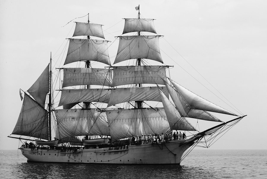
The Marengo was a barque [a large multi-masted boat that transported cargo and goods on ocean voyages]. It went ashore in Widewall Bay close to Hoxa Head on October 10, 1840 [see Scapa Flow Wrecks]. Over 300 years, 28 boats were recorded as being lost close to Hoxa Head. According to Billy, it was a wooden fishing boat that went ashore at Hoxa Head and the cabin was rescued and used here as a garden shed. Whatever the case, the new housing and facilities were named after the barque.
Church Road and St. Margaret’s
From here, it is worth turning right onto Marengo Road and then left onto Church Road. Before starting uphill, look back down the road to the bay. At the bottom, on the left, is the St Margaret’s Hope Gospel Hall.
Up the hill, we find Doull’s Store, and to the left of the entrance are another two QR codes. 17) is about Doulls itself and 18) is about vans.
Stop 17: Doulls
Yvonne Widdall and Jane Phillips.
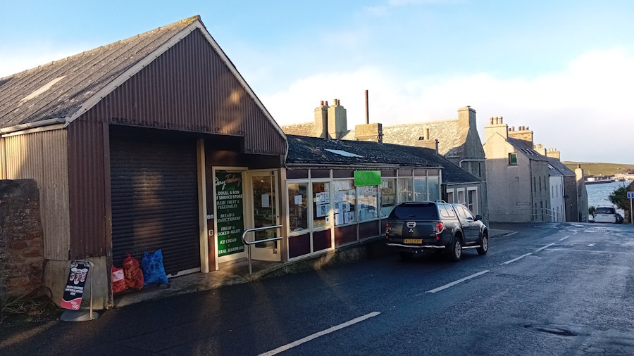
Today, Doulls carries a comprehensive range of goods, from hardware and toiletries to a wide selection of foodstuffs. It has grown considerably in size since the early days. The house on the corner has been incorporated, and the building extended both forward and to the side of the original shop. Yvonne and Jane talk about Benny Doull and his father, Benjamin, and the work that went into baking the range of breads, buns, scones, pies and cookies that they made the focus of the shop and of the sales van.
Stop 18: Vans
Dick Brown, Yvonne Widdall and Elma Rosie
Many of the shops had vans and some of them carried a range of products: from paraffin, through meat and groceries, to sweets and drinks. Initially, they were horse-drawn, and some of these were still in use in living memory. Deliveries would be made to people’s homes or to the start of the tracks that served them. Different parts of the island would receive deliveries on particular days of the week.
Across the road from Doulls is Robertson’s Coffee House and Bar. Robertson’s was, for many years, a merchant selling coal, farming goods and groceries.
Further up the hill is St Margaret’s Kirk. Even further up the hill and a left turn onto St Margaret’s Road and right turn onto the A961, you will find, by the war memorial, the QR code for 19) P.O.W.S.
Stop 19: POW’s
Dick Brown and Billy Dass
In this short piece, Dick and Billy look back on their encounters with Italian prisoners of war. There had been a significant number located close by because of their involvement in building the Barriers.
You can return to Cromarty Square by walking back down Church Road and turning left just past Doulls. This takes you down Back Road. It goes past another product of community-led activity: the children’s play area. A little further on, you will see a short road to Front Road on your right and next to the Murray Arms is another road to your left.

Close to here, you will find another two QR Codes in the left window of the Murray Arms opposite the turning to Front Road. QR code 10 tells the story of two of Winston Churchill’s visits to St Margaret’s Hope (he was here on both naval and defence issues, particularly linked to the construction of the Barriers). Click to listen
Stop 10: Churchill
Fred Brown and Billy Dass
This stop by a window in the Murray Arms is halfway between two encounters with Winston Churchill. The first was in the early days of the Second World War and involved Churchill talking with Herbert Mackenzie (Senior) in his shop on Front Road. The second encounter was several years later, when Winston Churchill was waiting in the cold for a boat at the Pier. He took refuge in the shop in front of the bakehouse on Back Road, and had tea and a scone served up by Jim Fred. [The shop is on one side of Betty City (pathway), The Trading Post is on the other – see Stop 10a below].
Stop 10a: Back Road
Dick Brown
In this piece, Dick runs through the shops and offices on Back Road and Church Road. At this point, what we describe on the map as James Flaws Outfitters (based in what we now know as The Trading Post) had been taken over first by Russel and Annal Drapers and then by John Sinclair, Draper.
Returning to the square, you will find further examples of community-led activity – The Cromarty Hall and The Smiddy Museum. A few metres along St. Margaret’s Road is a car park for three more community initiatives the golf course, the bowling green and the tennis court.
School Road
Walk up School Road past the Smiddy Museum. It is a fairly steep hill. Just before the tennis court and bowling green, on the opposite side of the road, you will see a track. Walk a few metres up it, and look to your right. You will see a garden and a shed. This is listed as the site of Sant Margrat in the Howp (St Margaret’s Chapel).
There is a further stop on the St Margaret’s Hope Listening Walk by the school if you have the energy. Continue climbing the hill. One concerns the tennis court – 20). Tennis Court. The other involves reflections by old pupils on life in the old school. You will pass three houses on your left, and then the old school (now a Healthy Living Centre) on your right. The QR codes are on the wall ahead of you, where the path turns into the school.
Stop 20: Tennis Court
Billy Dass, Denise Denvir, Herbert Mackenzie and Robert Rosie
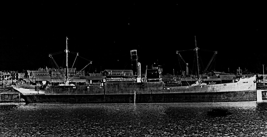
At this stop, we hear about the loss of lives and of ships during the Second World War as a result of bombs dropped by planes and torpedoes from submarines. One of these was the SS Giralda. It had been sailing from Ayr to Kirkwall with a cargo of coal and sank around 3 miles south east of South Ronaldsay on January 30, 1940. Some crew members were able to get into a lifeboat and head for the shore. Unfortunately, just a short distance away from safety, the boat overturned – and all were lost in the freezing waters. A significant number of islanders and service personnel had gone to help. Among them, as the Orkney News reports, were farmers Archibald Bichan and John Cromarty. They:
tied a rope around their waists and, even though they could not swim, they plunged into the surf to attempt to rescue some of the men. Archibald Bichan and John Cromarty worked away in freezing waters for an hour and half recovering 11 bodies.
Sadly, all crew members were lost, and the Cromarty Hall was used to hold bodies while coffins were made. Many of those who died were from Shetland. Archie Bichan and John Cromarty were later to receive medals for their bravery. Other ships lost during the Second World War to the east of South Ronaldsay include HMS Bancrest, SS Svinta, SS Loch Maddy and SS Tiberton. The stone of remembrance for the 24 SS Giralda sailors who lost their lives is in the St Olaf Cemetery, Orquil Road, Kirkwall (see below). Click for details of those who lost their lives.

What does all this have to do with the tennis court, you might be asking? The answer: Archie and John were to be awarded their medals there. A band and around 100 soldiers marched up from the Cromarty Square to the tennis courts, where local people were waiting for them. As the ceremony was taking place, two German planes flew overhead and dropped two bombs (which landed some distance away). It was not an unusual occurrence in Orkney (click for an example, just two weeks before the Giralda sank).
Stop 1: School
Billy Dass, Herbert Mackenzie, Jimmy Wishart

This stop has three reminiscences about early experiences of going to school. The first concerns playing in the deep snow on the opposite side of School Road in 1948 and then coming into school (Herbert Mackenzie). Secondly, we hear from Jimmy Wishart about the experience of the first day at school. This includes entering the classroom (which, in this case, had an old-fashioned, tiered design) and crying at the strangeness of the first day experience. These tears were soon dispelled thanks to the teacher’s threat to take the belt to the new arrival, sadly, a not uncommon occurrence. Last, Billy Dass talks about hitching a lift to school in the back of an army lorry, being stopped by the military police (Redcaps), and being ejected.
Visit the school’s page to learn more.
There are just two more stops to complete the Listening Walk. Just return to Cromarty Square and then walk along past where the cafe was, and then, along Pier Road next to the sea, to the Harbour.
Hope Pier, Pentland Ferries and the Ferry Terminal – farming, fishing and ferries
Take care, as there is no pavement, which could cause problems for those with mobility difficulties. You will see plenty of interesting and sometimes rare seabirds, and grey seals at the right time of year (October-December). One of the fascinating things about bird life just here is that there are three different zones. The first is made up largely of seabirds like ducks, gulls, terns, redshanks, cormorants, curlews, oystercatchers, herons and the odd great northern diver; the second is the realm of familiar ‘house’ birds like sparrows, robins, wrens, blackbirds, starlings and pigeons; and the third, as you go up the hill, involves pheasants, finches, bunting, warblers and rarer birds
 About halfway along the road, you will find an old Bothy [which is part of Smiddy Banks]. It has served various purposes: housing (for around 13 people at times), a hospital/clinic, and storage.
A little further on, you will see the last two stops on the listening walk. They are on the second post along the front of the dock. As can be seen from the picture, there is parking close by. Currently, they are to the left of the model lighthouse (but this may be moved). Alternatively, click the following to listen.
Stop 6: Reflections on sailing and fishing
Herbert Mackenzie, Janice Thomson and Jimmy Wishart
Sailing and rowing boats around the bay, or east to Burray village, or west into Scapa Flow, could be great fun, but was not without its problems. Jimmy talks about taking the boat from Knockhall (which is on the opposite side of the bay from Stop 6) and out around the beacon (to your left) to fish. The catch could be fried up for tea. Herbert talks about some of the problems with currents and groundings around Knockhall and how local children would offer to “look after” boats coming up, for example, from Burray village. Jimmy then discusses attempting to use a makeshift sail with no luck, as the wind had dropped. This is followed by Herbert talking about “rowing up the bay, and blowing back”, and gradually being able to use sails. Janice rounds this off by reflecting on how terrifying it can be trying to sail or row to or from Burray village. [The farm she mentions is, essentially, the next one after Knockhall.]
Stop 7: Exploring the Pier
Janice Thomson and Jimmy Wishart
Jimmy begins by talking about some of the key boats that used to come into the Bay. These included vessels of the North of Scotland and Orkney and Shetland Steam Navigation Company and its predecessors, which appear to have sailed from Aberdeen from the 1790s. [The company was later taken over by P&O and then replaced by Northlink.] Other important boats brought coal for local providers such as Andrew Grays and Robertsons, and farming goods. As we saw at Stop 3, before the harbour was developed in the early 1900s, ships used to moor in the bay, and people, their luggage and things like the mail were taken to Spence’s Pier.
Janice talks about swimming in the bay – and more particularly, swimming from the Fourth Barrier to here.
You can walk a little further to the harbour itself. It is home to the Pentland Ferries catamarans [the Pentalina or Alfred], which cross the Pentland Firth three times a day, and to fishing boats and several vessels that serve the local fish farms. On the quayside and by the water’s edge, there are sheds and a slipway for servicing the boats and handling the fish. The wind turbine up on the hillside provides energy for the ferry and the ferry offices.
Elsewhere on these pages, we discuss the continuing significance of fishing, and now fish farming, to the Orkney economy. A considerable number of jobs have been created by the latter over the last decade or so, and this has certainly been the case here.
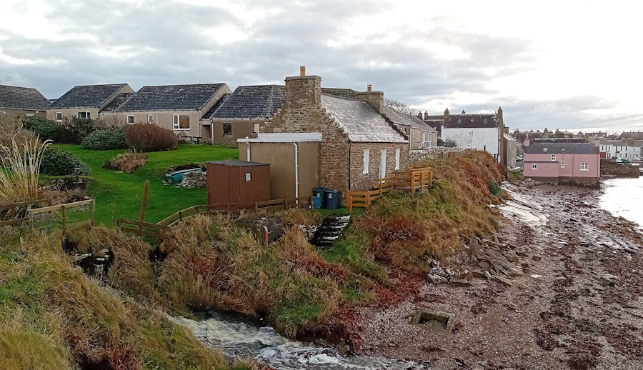
For those with energy to burn, you can walk along the track that runs behind the sheds and on to Needle Point. The cottage at the end of the track – The Ruff – is another former Harbour Master’s house. It is named after the bank stretching from this point to the beacon. Click for a map.
To learn more about the history and development of Pentland Ferries, you can listen to a fascinating discussion that first appeared on Radio Orkney in October 2024. Chaired by Karen Scholes, Andrew Banks, Kathryn Scollie, and Helen Inkster discuss ‘how the company started, what the future holds and the challenges along the way’.
Click to listen [the broadcast lasts around 55 minutes].
To return to the walk, you retrace your steps along the track and pick up the road.
Returning to the village
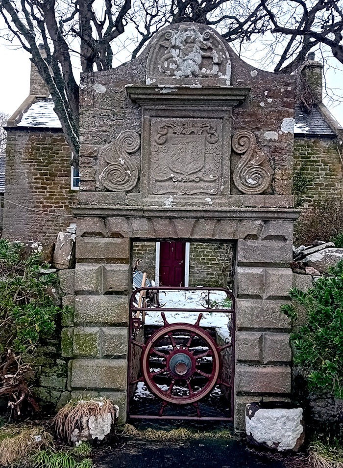
Rather than retracing your full route along the road, take the steps opposite the slipway (and just before the Bothy). At the top, you will see a Renaissance gateway at Smiddy Banks dating from the 1600s [Category B listed building]. The farmhouse was built on the site of a two-storey post-Medieval Mansion (Canmore). All the fields you have walked past next to the road from the village and the track after the harbour are part of this farm. It focuses on sheep and cattle and has belonged to the same family for nearly 200 years.
You can return to St Margaret’s Hope by walking down the farm track and picking up the road. If you have dogs, keep them on a lead. There are often lambs and sheep in the adjoining fields, and vehicles visiting the farmyard.
If you enjoyed the listening walk, you might like to take the sister walks around St Mary’s Kirk and Burwick, and St Peter’s Kirk, Eastside.
© The opening image is by Sheena Graham-George
If you find any mistakes in this piece or think something needs adding, please let us know.
All photographs without acknowledgement: mks | CC BY-NC-SA licence.
Referencing this page: Sheena Graham-George and contributors to The Listening Walk [with additional material from Ingrid and Herbert Mackenzie and Mark K Smith] (2025). Exploring St Margaret’s Hope – the listening walk. Exploring South Ronaldsay. St Margaret’s Hope. [https://exploringsouthronaldsay.net/st-margarets-hope/. Retrieved: insert date].
© Sheena Graham George and Exploring South Ronaldsay 2025
updated: June 3, 2026