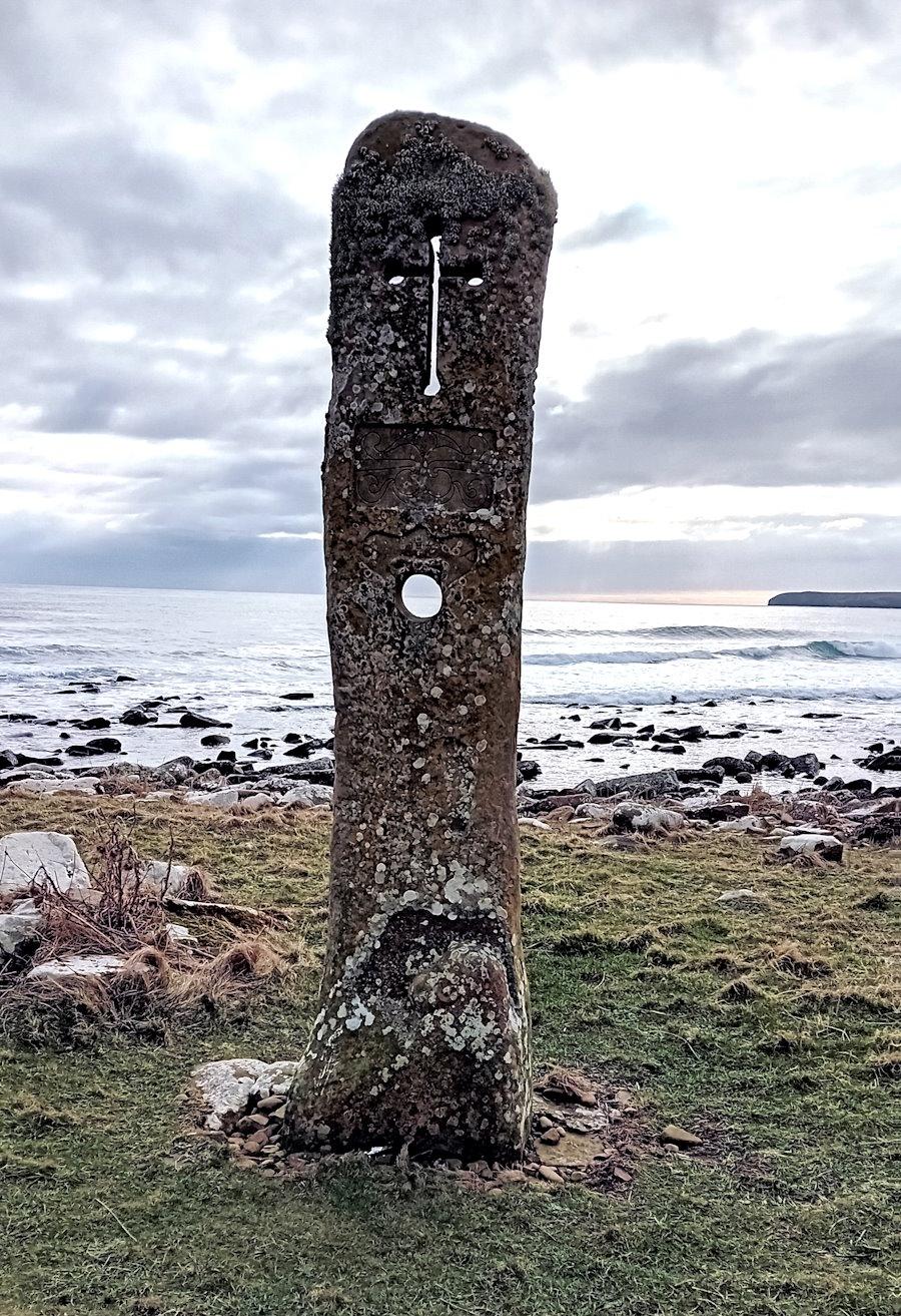
Picture: The Sorquoy Standing Stone, Kirkness. The old Manse can be seen to the right
First, a warning: on the island, many stones stand but are not of historic interest.
We have listed stones that appear on Canmore and The Megalithic Portal, and added one wonderful modern addition from Willie Budge – The Millennium Standing Stone on Kirkhouse Point.
East side
Sorquoy Standing Stone, Kirkhouse Road, South Ronaldsay (KW17 2TJ click for map). This is one of the larger standing stones in Orkney. It is over 14ft high. Getting to it requires some care, for while the route is marked as a path, it is not easy to follow. The walk is uneven and competes with a ditch for much of its length. Not suitable for wheelchair users, but visible from the road.

The Millennium Standing Stone, Kirkhouse Road, South Ronaldsay (KW17 2TJ, click for map). Created by a local craftsman, Willie Budge, this stone features various historical elements such as a dragon head, Pictish symbols, and a Viking longship. It also cleverly uses a hole that echoes that of The Stone of Odin at the Ness of Brodgar (click to read about the different interpretations of why the ‘Odin’ hole was created). Probably not suitable for wheelchair users.
Stews Standing Stone. If you continue south from Kirkhouse, you can pick up the East Coast walk, which takes you to Windwick and beyond. If you walk the length of the beach and pick up the path that runs close to the cliff edge, you will see Stew’s farm on your right. Stay on the East Coast walk. About 1/4 of a mile after the farm, you will see Stew’s Standing Stone. It is a triangular block of red sandstone just under 2m high (click for a short piece on the stone from the Northern Antiquarian, further details can be found on Canmore). There were two other stones here. On the east side of the standing stone is the site of Saint Ninian’s Chapel and burial ground. The stone can also be reached from Stews Road. Not suitable for wheelchair users.
West side

Clouduhall (aka Cloudiehall / Cloddyhall) Standing Stone. This stone is in a field opposite Cloudiehall and next to Sandwick Road. To the west, you will find a ‘gate’ to the field. The path takes you past an early Bronze Age cist and the site of a possible Neolithic chambered cairn (they are next to the road and about halfway between the entrance to the field and the standing stone). The stone is about 2.8m high and just under 1.4m wide (at its widest point). Not suitable for wheelchair users but visible from the road.
Opening photograph – Sorquoy Standing Stone | All photographs – mks – ccbyaas2 licence.
Referencing this page: Smith, M. K. (2025). Standing stones in South Ronaldsay. Exploring South Ronaldsay. St Margaret’s Hope. https://exploringsouthronaldsay.net/standing-stones-in-south-ronaldsay/. Retrieved: ]
updated: May 28, 2025
