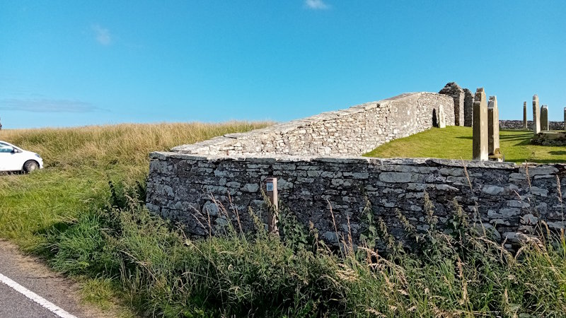
For those who don’t know about Burwick, it is in the south of South Ronaldsay. If you are biking or coming by car, all you do is follow the A961. The road ends at Burwick pier. As can be seen from the map, it goes past the old church. If there is no space in the small car park just before the churchyard, there is plenty of space beyond the old farm by the pier. Walkers coming down the west coast will end up at the same place.
On Fridays (from 7.40 am until 6.30 pm) and Saturdays (from 9.40 am until 3.10pm), the South Ronaldsay Community Connect Bus operates. Click to find out how to book a ticket.
Sheena Graham-George
The Burwick, Kirkhouse, and St Margaret’s Hope Listening Walks (and their associated maps) featured on these pages were developed from two grants awarded to local artist Sheena Graham-George by the Culture Collective Fund to bring communities together after Covid. She worked with different folks in the community. The result is a fascinating collage of local life. You can view other elements of Sheena’s work via her website: https://www.sheenagrahamgeorge.com/.
Old St Mary’s Church
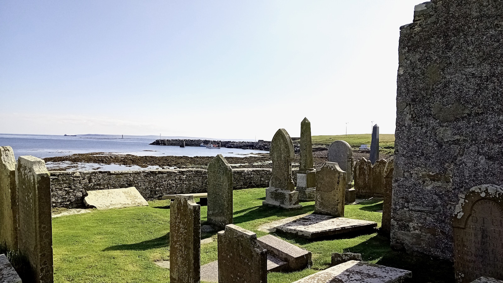
Old St Mary’s Church, aka Lady Kirk (click for map), was probably established at this spot in the 11th century. However, the first record of it on a map dates from 1654. Before the opening of the Lady Kirk, there was a chapel (St Colm’s), a few hundred metres to the east, dating from the ninth century or earlier [for more on this, visit our page on local churches and chapels].
Burwick’s coast is said to be where the earliest Christian missionaries landed in the Isles. Adomnan, the ninth Abbot of Iona and the writer of Life of Columba (Vita Columbae), reports that Cormac Ua Liatháin arrived around 580 AD. He had probably sailed around the mainland from Iona, where St Columba’s monastery was based.
 The South Kirk (St Mary’s) and Kirkyard and Kirkyard Gateway were deemed, in 1971, to be a Category B Listed Building. Historic Environment Scotland describes it as a ‘good example of a late 18th Century Orcadian parish church’.
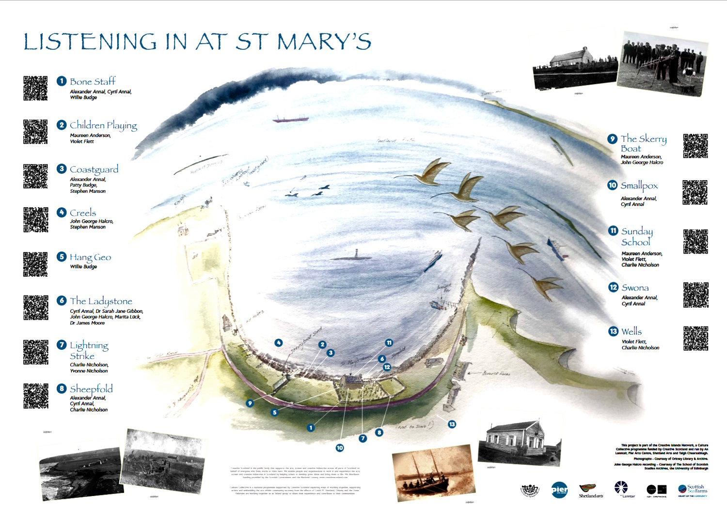
The walk
There are thirteen stops on this short walk, which takes the form of three circles. While we start with stops 1-4, the subsequent ones become more random.
To hear the story, you can either use your mobile device to read the QR code at the stopping point or just click the play button [a small triangle pointing right] on the left of the black band. You can adjust the volume on the right and go back and forward by clicking on the blue control.
The first circle
Stop 1: Bone Staff
Alexander Annal, Cyril Annal, Willie Budge
5min 55secs
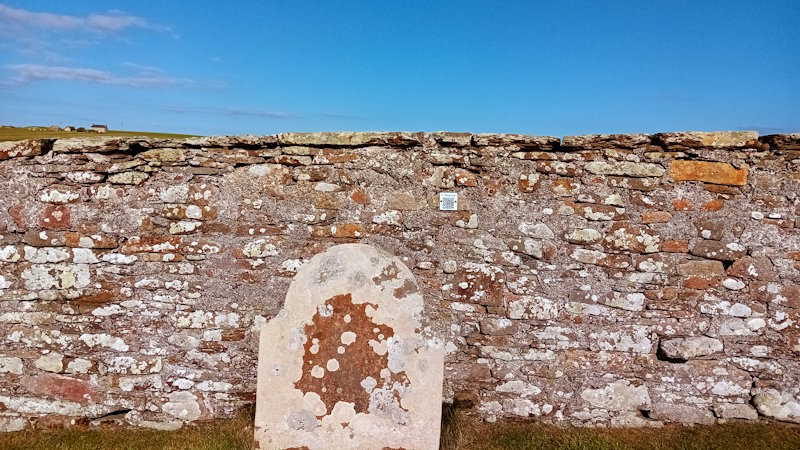
Bone Staff tells the story of a former ‘hunched-back’ resident of Burwick who appears to have never done any good for his neighbours and who, apparently, walked around with a sour face. His disability required him to use a walking stick. It was made from a whale’s rib bone, and this led to his nickname – ‘Bone Staff’. In 1761, it is said that, as a young man, he lured a boat (the Johanna Maria) full of pickled salmon onto the rocks, with the loss of most of the crew. This was to prey on his mind and, it is suggested, led him to commit suicide later. He is said to be buried here outside this corner of the graveyard (by Stop 1). Suicides were not allowed space on consecrated ground.
We move on to stops 2 and 3. This entails walking up the path to the beach and turning left (east). It is a short distance to the post on your left, which has two links.
Stop 2: Children Playing
Maureen Anderson, Violet Flett
1min 51secs
Children Playing describes some of the experiences of their use of this area between the church and the boathouse, and of being in the sea. It also reports getting up to mischief in the church and the boat shed, and how a kind local man used to keep his eye on them. It is said that he lived at Broch, which is possibly a reference to a house on the eastern coastline to the left of the pole in the picture above.
Stop 3. Coastguard
Alexander Annal, Pattie Budge, Stephen Manson
4min 36secs
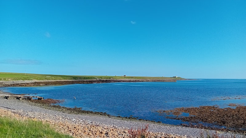
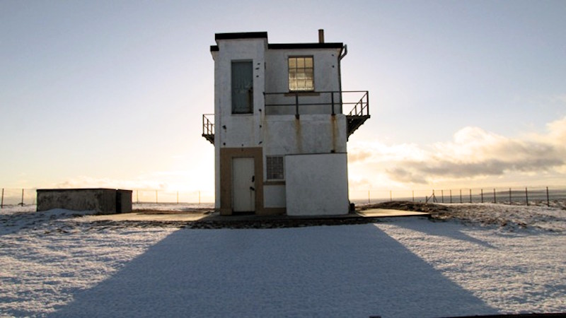
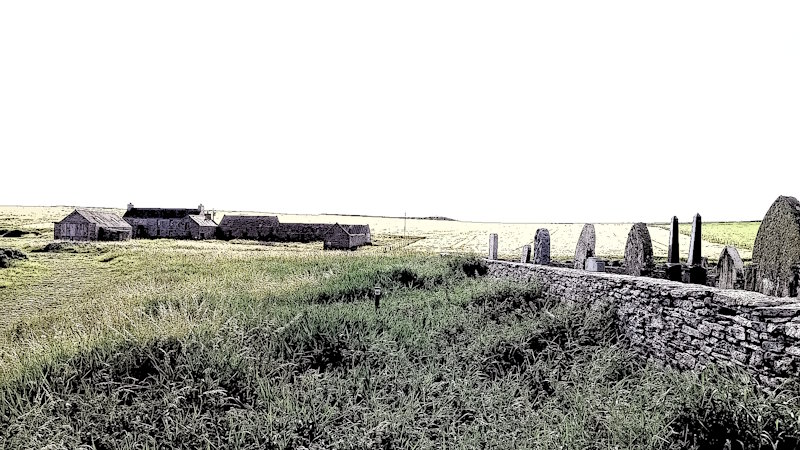
Coastguard discusses some of the experiences of local men in the Coastguard volunteers. At any one time, there could be just over 20 South Parish men involved with the Coastguards. They had a lookout station just beyond the end of Brough Road (which runs from the last turning before Burwick on the A961). In the photograph above, which is taken from close to Stop 3, you can see Brough Farm towards the tip of the coastline. The lookout station was a bit further south and just to the left. You can see it marked in the top left of the opening map. Below you can see a photograph of the Station.
The lookout was sited here as the Pentland Firth has tidal currents that are said to be among the fastest in the world. When combined with high winds, they create very challenging sea conditions. This has resulted in the loss of a large number of boats and ships, and their crew members. The station looks out to the Pentland Skerries – four uninhabited islands, the largest of which (Muckle Skerry) has two lighthouses.
Stop 4: Creels
John George Halcro, Stephen Manson
3min 10secs
You carry on for a short distance along the coast, and you will come across Stop 4 a few steps beyond the boat shed. The plate with the link on it was broken when last examined – so the only way to listen to Creels is to click on our link above.
A creel was a
Stop 9: The Skerry Boat
Mauren Anderson, John George Halcro
3 min 42secs
This shed was where the boat was kept for travel to and from the Pentland Skerries, the four now uninhabited islands just south of South Ronaldsay. The key destination was the largest island, Muckle Skerry. Since 1794, there have been two lighthouses – a ‘double light’. It was established by Thomas Smith and Robert Stephenson. The aim was to enable ships to navigate the Pentland Firth with relative safety and avoid having to travel around Orkney. (Click to see their history on the Northern Lighthouse Board website). Also on the island was a ‘family station’ which housed their families. The Skerry boat was, therefore, needed to transport people and goods (and animals) to and from the island. The family station closed in the 1950s and relocated to Stromness along with lighthouse families from Stroma and Copinsay. (Click to read an interesting article on the Stromness Shore Station). In 1972, the lighthouse keepers began to be taken to and from the island by helicopter. The lighthouse became fully automated in 1994. Historic Environment Scotland describes the station as ‘one of the first lighthouses built for Commissioners of Northern Lighthouses’. It was upgraded from a Category B listed building to a Category A building in 1998.
Maureen Anderson discusses her experiences on the boat, including what it was like to go down the slipway on it (her father sailed the boat). She also describes the various people, such as engineers and farm workers, who had to go to the islands. There were, for example, sheep on Muckle Skerry, and the maintenance of the lighthouses required specialist skills.
If you turn back to the road and look a little to the east, Sant Colmis / St Colm’s, a medieval chapel, was just a few steps along, beside what was then the Loch of Burwick (click for map).
The second circle – around the churchyard
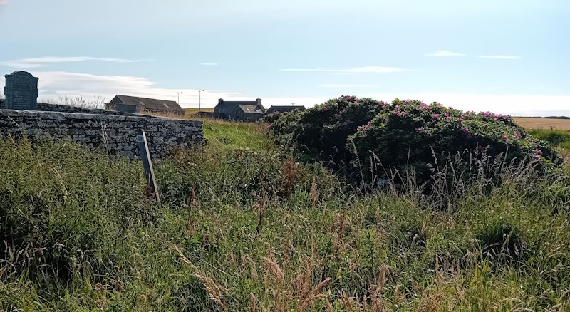
We enter the churchyard by the gate on the short path from the car park – and then turn seaward. On the wall to the left, you will find the intriguingly named Hang Geo (stop 5).
Stop 5: Hang Geo
Willie Budge
3min 48sec
This gravestone is said to mark the grave of a young man (James Thomas) who died in 1799. On the recording, Willie Budge describes the incident that led to his death at Hang Geo. A Geo is an inlet, a gully or a narrow and deep cleft in the face of a cliff (Wikipedia) – and Hang Geo is up the coast from Burwick and is east of Barswick. It seems he was at the helm of a boat, the Edinburgh of Leith, that ran into trouble here. James died hanging from his head on the cliff. Click to see Hang Geo on the map.
Willie also tells the story of an Orkney man who had a ‘brick’ of tobacco tied around his waist, who seemingly fell ill from this, but recovered after it was removed. A ‘brick’ was, basically, a large, compressed block of chewing tobacco that could also be used in a pipe.
There is also another fascinating graveyard story concerning the reopening of the burials of several fishermen, which is reported in Marshall’s excellent book Storm’s Edge (2024: 227-9). In October 1666, the minister (Edward Richardson) was approached by the three wives of the lost fishermen and a bereaved mother. It was claimed that the men’s ghosts were appearing as a result of local people (witches) being responsible for the deaths, and that a reopening of the graves would bring their wickedness to light. Richardson ordered the reopening for the next day in front of many of those involved in the original burial. No accusatory signs were experienced, and Richardson declared the matter closed, stating that malicious and evil thoughts towards those supposedly involved should be set aside.
From here, we take a few steps to the sea-facing side of the church and then walk along to Stop 11 in the middle of the chapel.
According to Scottish Church Heritage Research (SCHR), there was an earlier church (built before 1440) on the site, which replaced St Colm’s (see above). The current Old St Mary’s Church/ the Lady Kirk was built in 1788. Its interior was refurbished in 1896. From around 1959, it was only used for occasional services. In 2013, it was struck by lightning, suffered significant damage, and was placed on the Buildings at Risk Register. Orkney Island’s Council then issued a repair enforcement action on the Church of Scotland, and the building was made watertight and windproof and put up for sale in 2016 (details taken from Scotland’s Churches Trust). Thankfully, local people established the St Mary’s Preservation Trust and were able to purchase the church and open it.
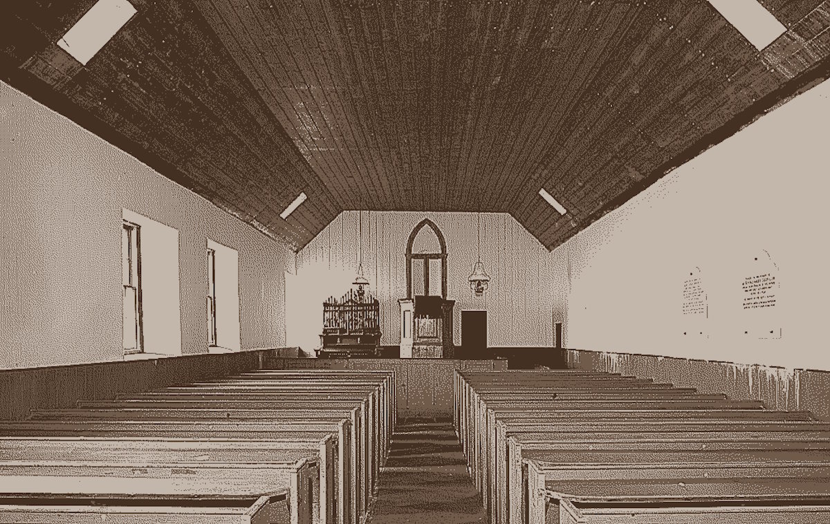
If the church isn’t open, you can look through the windows close to Stop 11 on the south side. The organ and pulpit are to the left, and you will see the stalls filling the rest of the church. The choir sat in the box by the organ and the pulpit. Next to them is the door to the area where the Ladystone is now kept [see stop 6].
Stop 11: Sunday School
Maureen Anderson, Violet Flett, Charlie Nicholson
3min 44sec
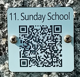 Many of the children attending had to spend quite a lot of Sunday in the church. As you hear when you play Stop 11, quite a few had to attend Sunday School and then stay for the Service, as they were also members of the choir. As the opening speaker recalls, they were expected to be there for all but a couple of Sundays, and there were other tasks, such as learning the verses they were expected to sing.
We now head to the west end of the church, the ‘back door’ and stop 6.
Stop 6: The Ladystone
Cyril Annal, Dr Sarah Jane Gibbon, John George Halcro, Marita Lück, Dr James Moore.
6min 44secs
The church houses a rounded grey whin stone, carved with two footprints. It is one of the three ‘foot’ stones found in Orkney. Believed to be a Pictish coronation stone, it may well have been made in the late Iron Age. As we hear from the contributors to Stop 6, the King to be, would stand on the stone with their feet in the two footprints.
As we hear from the contributors to the Talking Walk, there are various stories associated with the Stone and the feet portrayed on it. Standing on the stone was a way for the new King to demonstrate his marriage to the land. As one of the contributors says, it was a sacred marriage that would ensure the fertility of the earth and the crops that grew here and, in turn, the well-being and prosperity of the people.
It is also suggested that these double footprint stones are associated with saints. In the case of this stone, there are stories of it originally being a whale. One of the stories is that it was the whale that brought Magnus across the Pentland Firth. In many respects, Burwick was the gateway to Orkney – it was the obvious (and closest) place where people would land when crossing from Caithness. Those travelling by sea from Ireland and the west coast may also have landed here, but it is more likely that they would have used one of the larger, natural harbours of Scapa Flow, such as St Margaret’s Hope.
We also hear that in the Middle Ages, this church became important to pilgrims on their journey to honour St Magnus at the Cathedral in Kirkwall.
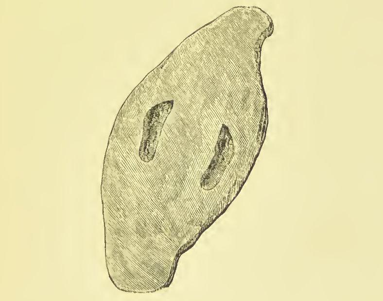 Image from George Low’s book (1879) A Tour through the Islands of Orkney and Shetland, page 27. Click to read.
The final bit of the second circle is concerned with two disasters. The first is on the north side of the Church – just after you turn the corner.
Stop 7: Lightning Strike
Charlie Nicholson, Yvonne Nicholson
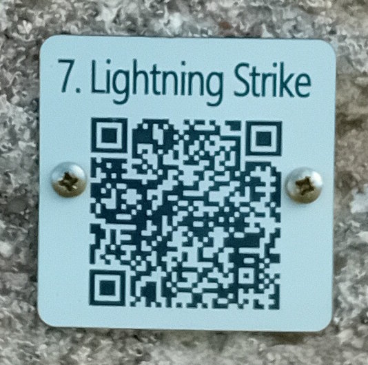
The church was hit by what appears to have been a huge lightning strike in 2013. It struck the bellcote and created quite a hole in the roof, which, in turn, led to rain damage to the interior. As Charlie Nicholson and Yvonne Nicholson report, it appears the pipes from the roof conducted the lightning to the ground and then burnt tracks in the graveyard. Gravestones were broken, and the graveyard walls were damaged.
The building was quickly listed in the national Buildings at Risk Register. Orkney Islands Council “issued a repair enforcement action on the Church of Scotland, requesting they address the damage and make the building wind and watertight” (Scotland Churches Trust). Repairs were made relatively quickly, and the building was put up for sale in 2016. A number of local people came together to create the St Mary’s Preservation Trust and were able to take over the building in 2017. The purposes of the Trust are to:
- support the restoration and preservation of the Church as a place of historical, social, religious and architectural importance; and
- provide a space for community use and enjoyment… and increase public knowledge of the history of the church, the geography, natural environment, culture and other features of life in the local area.
Stop 10: Smallpox
Alexander Annal, Cyril Annal
2min 11secs
Our final stop on this second circle can be found further along this north-facing wall.
Two local men had gone to Flotta to replace a roof on a building, and, unknown to them, they contracted smallpox, came home and died. In the process, smallpox spread to others. However, none of the local children and women contracted smallpox because they had been working with cattle with cowpox and had developed immunity. A number of those who died are buried in the graveyard in an area with no gravestones. Relatives didn’t have the money to commission them.
From here, we return to the south of the churchyard and the final circle. We need to walk around the church again and exit the churchyard through the back gate. We now turn right again onto the path that runs parallel with the sea.
The final circle – Swona, Burwick Farm and back to St Mary’s
As you follow the path, you will see Stop 12 among the plants to your right (not far from the graveyard wall). It is in the centre of the land shown below.
Stop 12: Swona
Alexander Annal, Cyril Annal
2min 25secs
The island of Swona is not visible from here, but can be seen from the other side of the hill behind the old farmstead ahead of you. A second walk on this page, up to the Castle of Burwick, will give a good view of this uninhabited island, when it has been written!
Swona is about two miles off the coast between Burwick and Bardswick. It has not been inhabited by humans since 1974, but it is home to a herd of feral cattle whose ancestors were left behind when the last people left the island. It is also a Site of Special Scientific Interest (a conservation area) as it has some rare plants. There is evidence that the island has been inhabited since around 500 BC. In its later years, it had a small number of farms, a lighthouse, and a boat builder. ‘Swona’ appears to have been taken from the Old Svíney or Swefney. These can be translated as “Swine Isle” or “Sweyn’s Isle” (see Wikipedia). There are occasional voyages to the island, and the only regular way of viewing it from reasonably close quarters is from the Gills Bay/St Margaret’s Hope ferry operated by Pentland Ferries.
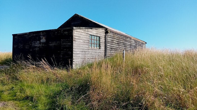
On the Swona recording, Alexander Annal and Cyril Annal talk about the journeys the Swona people made to attend church. It entailed sailing around 2.5 to 3 miles each way across what could be quite choppy water. They built a shed close to the slipway on the coast by Barswick so that they could put their Sunday best on when they arrived rather than getting it wet on the way across. The shed is still there and easily visited for much of the year.
This piece of coast is a favourite for grey seals (and their pups) from October to December, and it is not advisable to get close to them. However, it is possible to get a good view of the seals from the cliffs. [Harbour seals tend to ‘pup’ in July]. Click for an introduction to seals in Orkney.
Alexander and Cyril also mention the journeys that were not made. From 1820, the Burwick clergy wouldn’t cross the water to Swona. The result was that Swona people had to make the crossing. This also applied to them when they died – they had to be buried in the Burwick graveyard.
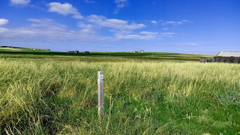
From Stop 12, you carry on along the track to the first turning, which takes you to the right side of the farm buildings. Crossing the road to the track to the side of the farmstead, you will find stop 13 by the corner of the next-door field.
The farmstead is uninhabited and Grade B-listed. It has been derelict since the early to mid-1970s. Bought by a couple in 2015, restoring the farmhouse and barn was a big project. They installed a new roof, replaced windows, and worked on the barn. However, it appears that they lost interest in the scheme and the life it entailed for them. The house, along with the large barn opposite, has been on the market for some time. The outbuildings to the right of the house do not appear to be included in the offer.
Stop 13: Wells
Violet Flett, Charlie Nicholson
1min 30secs
It is only in fairly recent years that properties in this part of the island were connected to water pipes. People had to walk to the nearest well, which for some might have been located in their own garden. Charlie tells the story of visiting his well at night and being shocked to find two eyes peering back at him. It was a seal.
From stop 13, you walk along the road towards the church. On your right, you will see what was a sheepfold (an enclosure/shelter for sheep). The first recorded evidence of sheepfolds dates back to the twelfth century.
Stop 8: Sheepfold
Alexander Annal, Cyril Annal, Charlie Nicholson
1min 53secs
Sheepfolds often had several pens within them. They were frequently used where sheep from different farms were on common grazing grounds. Within the sheepfold, animals could be separated into their farm flocks.
As we hear from the contributors to Stop 8, sheep were often brought to the Sheepfold at night – particularly when lambs were due. It was a contained spot that didn’t involve trying to find the ewe. Another interesting aspect concerns the burial here of those born outside wedlock. They used to be buried in this stone enclosure, well away from those deemed ‘legitimate’ in the graveyard.
This concludes the Burwick listening walk. If you enjoyed the walk, you might want to try the sister walks in St Margaret’s Hope and St Peter’s Kirk, Eastside.
Further reading
There are various books about Orkney as a whole, but only a few that focus on Burray and South Ronaldsay. Here are three to start with:
Picken, S. D. B. (1972). The Soul of an Orkney Parish. Kirkwall: The Kirkwall Press. https://archive.org/details/souloforkneypari0000stua.
Struthers, J. M. (2013). Broch Island. A history of the island of Burray in Orkney. Published by J. M. Struthers via lulu.com.
Watson, The Revd Mr. James. (1795). United Parishes of South Ronaldsay and Burray. Statistical Accounts of Scotland – OSA Vol XV: https://stataccscot.ed.ac.uk/static/statacc/dist/viewer/osa-vol15-Parish_record_for_Ronaldshay_and_Burray_in_the_county_of_Orkney_in_volume_15_of_account_1/
One further excellent study of Orkney that uses quite a bit of material from the two islands is:
Marshall, Peter. (2024). Storm’s Edge. Life, death and magic in the Islands of Orkney. London: William Collins.
If you find any mistakes in this piece or think something needs adding, please let us know.
All photographs without acknowledgement: mks | CC BY-NC-SA licence.
© The opening image is by Sheena Graham-George
Referencing this page: Sheena Graham-George and contributors to The Listening Walk [with additional material from Mark K Smith] (2026). Exploring and visiting Burwick, Exploring South Ronaldsay. St Margaret’s Hope. [https://exploringsouthronaldsay.net/exploring-and-visiting-burwick. Retrieved: insert date].
© Sheena Graham-George and Exploring South Ronaldsay 2025
updated: January 28, 2026